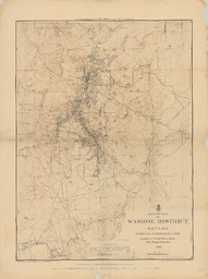
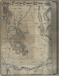
Outline Map of Washoe District, Nevada. Image Read more about Outline Map of Washoe District, Nevada.
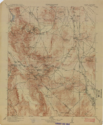
Nevada-California Lida Quadrangle Topography (Tonopah) Image Read more about Nevada-California Lida Quadrangle Topography (Tonopah)
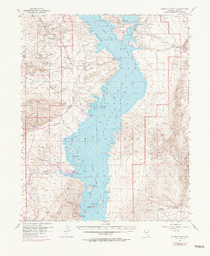
Overton Beach Quadrangle Nevada-Clark Co. 15 Minute Series (Topographic) Image Read more about Overton Beach Quadrangle Nevada-Clark Co. 15 Minute Series (Topographic)
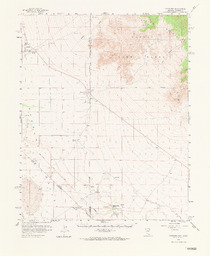
Pahrump Quadrangle Nevada-California 15 Minute Series (Topographic) Image Read more about Pahrump Quadrangle Nevada-California 15 Minute Series (Topographic)
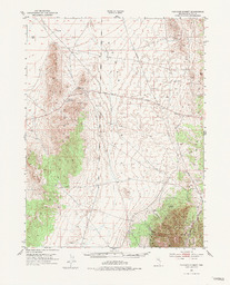
Pancake Summit Quadrangle Nevada-White Pine Co. 15 Minute Series (Topographic) Image Read more about Pancake Summit Quadrangle Nevada-White Pine Co. 15 Minute Series (Topographic)
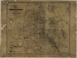
Official Map of the Washoe Mining Region with relative distances from the principal Places Image Read more about Official Map of the Washoe Mining Region with relative distances from the principal Places
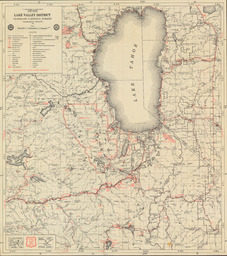
Lake Valley District Eldorado National Forest California Region Image Read more about Lake Valley District Eldorado National Forest California Region
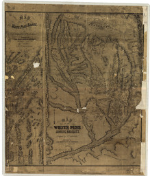
Map of the White Pine Range| Map of the White Pine Mining District Image Read more about Map of the White Pine Range| Map of the White Pine Mining District
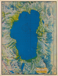
E.R. Smith Map of Lake Tahoe & Vicinity Image Read more about E.R. Smith Map of Lake Tahoe & Vicinity